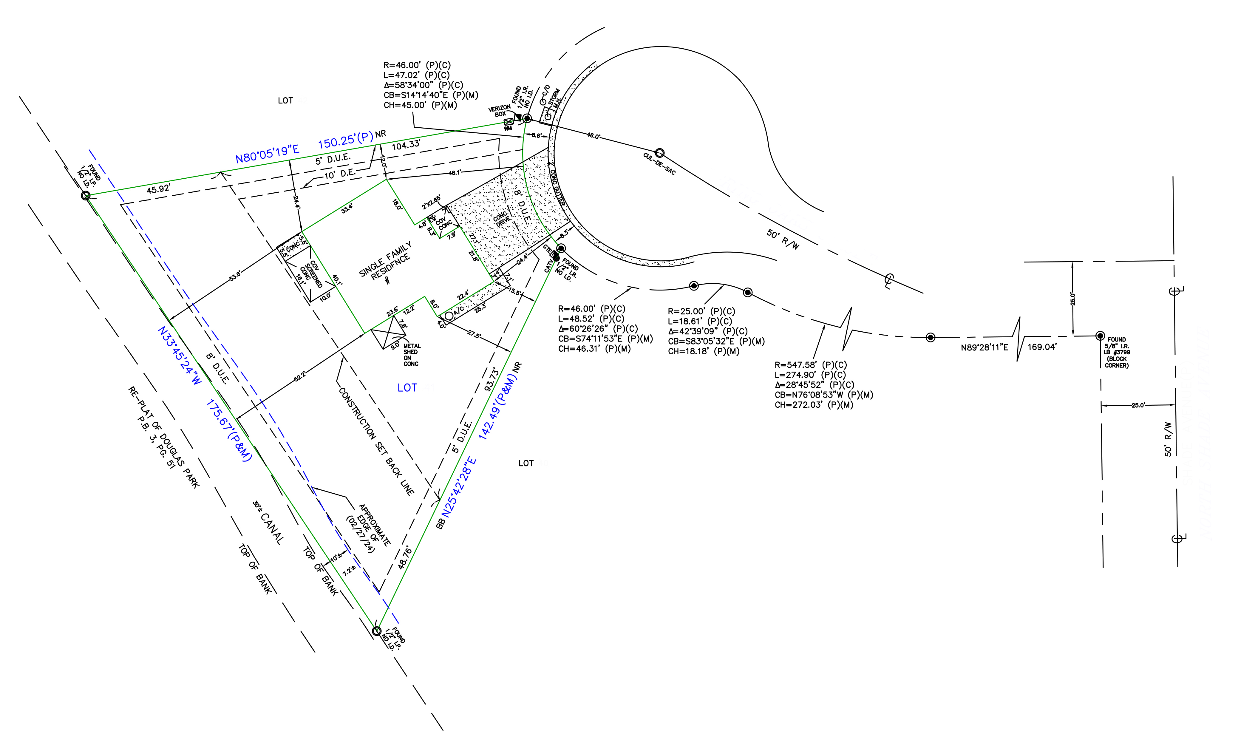
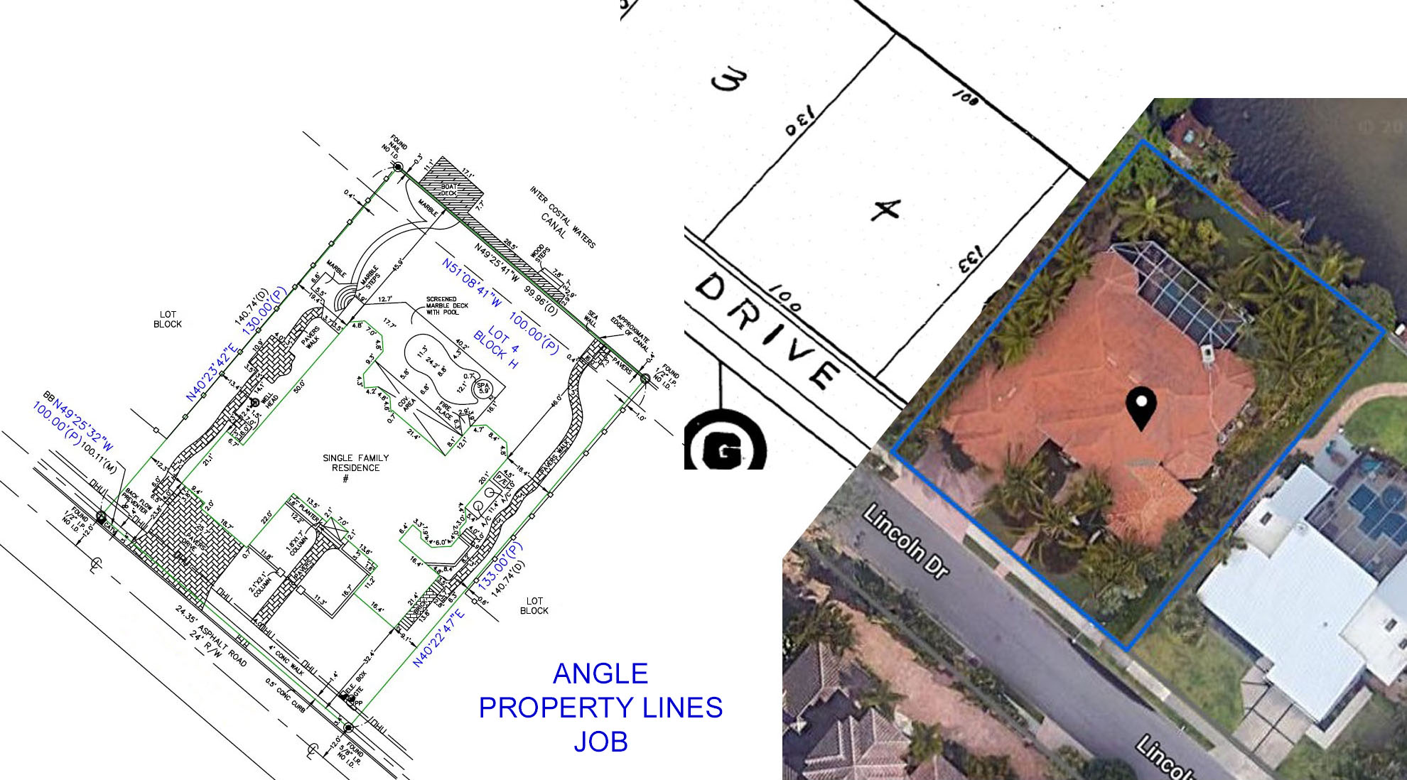
Boundary Survey Drafting
Boundary Survey Drafting involves the creation of precise technical drawings that define property lines, easements, and site boundaries using legal land survey data. This project focused on drafting a detailed lot plan incorporating curve data, setback lines, easements, and topographical features to support development, permitting, and property transfer.
The Challenge
The property had a combination of straight and curved boundaries, drainage easements, and a canal along one edge. The client required an accurate boundary representation that would comply with local codes and provide clarity for both development and legal use. Complex curve data and overlapping utility easements made the layout more challenging.
Our Solution
Our team used certified field survey data and plat references to produce a CAD drawing with precise bearing angles, distances, curve radii, and setback lines. We accounted for drainage easements (D.U.E.), top-of-bank measurements, and public right-of-way access. Special attention was given to curved lot lines and chord definitions to ensure legal compliance and buildability.
Results
The final boundary survey drawing passed municipal review on the first submission. It enabled the client to confidently proceed with design planning and property transfer documentation. The accuracy of the boundary definitions also helped avoid potential legal conflicts with adjacent parcels.
Project Features
- Accurate boundary plotting using field survey data
- Bearing and distance annotations with curve data
- Drainage & utility easement (D.U.E.) mapping
- Top of bank, setback, and right-of-way delineation
- Lot-specific property lines with legal references
- CAD-ready files compliant with local zoning standards
Need a Similar Project?
Contact our team to discuss your AutoCAD requirements and get a customized solution.
Request a Quote"CAD Cosmo delivered a boundary survey draft that was both technically sound and visually clear. It streamlined our permitting process and gave our legal team exactly what they needed for the land transfer."
Samantha Lee
Project Coordinator, Horizon Land Group
Related Projects
Explore more of our work in similar areas
Ready to Start Your CAD Project?
Let our team of experts bring your vision to life with precision and excellence.